Photogrammetry, at its core, is a technique that uses photographs to gather measurements and create accurate models of objects, terrain, or structures. For many decades, this method has been indispensable in fields such as surveying, cartography, and architecture. However, with technological advancements, digital photogrammetry has emerged as a more efficient and accurate successor, incorporating cutting-edge digital tools and software.
Photogrammetry is the science of making measurements from photographs. It is a technique that allows users to convert two-dimensional images into three-dimensional models or maps by capturing a series of photographs from various angles. This approach has been in use for over a century, originally employed in aerial surveying to create topographical maps. The primary objective of photogrammetry is to obtain spatial data about an object, landscape, or feature without physically interacting with it.
Photogrammetry relies on the principles of geometry. By analyzing the geometric relationships between multiple overlapping photographs, distances between objects in the photos can be accurately calculated. These calculations are often done manually, using traditional tools like analog cameras, photographic plates, and optical instruments.
The Basic Process of Traditional Photogrammetry
The process of photogrammetry involves several key steps, each critical to ensuring accurate data collection. Here’s a brief breakdown:
- Image Capture: Cameras are used to take multiple photographs of a scene from different angles. In traditional photogrammetry, this was typically done using film-based cameras, either handheld or mounted on aircraft for aerial photography.
- Control Points: Reference points on the ground (or object) are marked, and their precise coordinates are known. These control points are crucial for scaling and orienting the photogrammetric model.
- Photographic Interpretation: In traditional photogrammetry, skilled technicians would manually examine the photographs to determine relative positions and dimensions of objects. This was done using special optical devices like stereoscopes, which allowed the viewer to see images in 3D.
- Manual Calculation: The distances, angles, and elevations between points in the photos are calculated through geometric triangulation, requiring expertise in mathematics and geometry.
Applications of Photogrammetry
Traditional photogrammetry has long been a valuable tool in industries where spatial accuracy is essential. Some common applications include:
- Topographical Mapping: One of the earliest and most prominent uses of photogrammetry has been in creating detailed maps of landscapes and terrain, especially in inaccessible areas.
- Architecture and Civil Engineering: Architects and engineers have used photogrammetry to measure and model buildings, bridges, and other structures, aiding in the design and construction processes.
- Archaeology: Photogrammetry has been used to document archaeological sites and artifacts without the need for invasive techniques.
- Forestry: By capturing aerial images of forested areas, photogrammetry has assisted in forest management, helping to map out tree canopies and track deforestation.
In traditional photogrammetry, the manual nature of the process meant that it was time-consuming and required a high level of expertise. Despite these limitations, it has laid the groundwork for modern digital methods that have transformed the field.

What Is Digital Photogrammetry?
Definition of Digital Photogrammetry
Digital photogrammetry is the modern evolution of traditional photogrammetry, utilizing advanced digital technologies to capture, process, and analyze photographic data. Unlike traditional methods, which required manual interpretation of images, digital photogrammetry automates much of the process through the use of high-resolution digital cameras, drones, and sophisticated software. This enables faster, more precise, and scalable results.
At its core, digital photogrammetry follows the same principles as its traditional counterpart—using images to extract spatial information—but leverages the power of computing and automation to significantly enhance efficiency and accuracy. Digital tools enable users to capture a large volume of data, process it in real-time, and generate detailed 3D models or maps with minimal human intervention.
How Digital Photogrammetry Works
The workflow in digital photogrammetry consists of several key steps, many of which are automated, making the process quicker and more accurate than traditional methods. Here’s a look at how it typically works:
- Image Capture with Digital Devices: Digital photogrammetry uses digital cameras, drones, or even satellite imagery to capture high-resolution images. Modern digital cameras and sensors are capable of capturing images with incredible precision and detail, which is crucial for producing accurate 3D models. Drones have especially revolutionized the field by offering an easy, cost-effective way to capture aerial images.
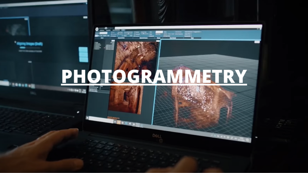
- Automated Processing Using Photogrammetry Software: One of the biggest distinctions of digital photogrammetry is the use of specialized software. After the images are captured, they are uploaded into photogrammetry software, such as Agisoft Metashape, Pix4D, or DroneDeploy, which automatically detects control points, calculates distances, and generates 3D models through algorithms. The software can handle large datasets, process images in parallel, and extract spatial information far more efficiently than manual methods.
- Generation of 3D Models and Point Clouds: Using the processed data, the software generates point clouds, which are sets of data points in space that represent the object or landscape. These point clouds can be used to create 3D meshes, surface models, and textured models. The results are precise, and the level of detail can be adjusted depending on the quality of the images and the processing settings.
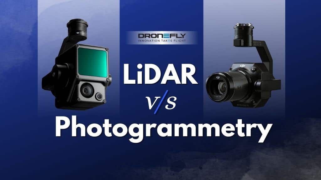
- Integration with Other Data Sources: Digital photogrammetry can also integrate data from other sources, such as LiDAR (Light Detection and Ranging), GPS coordinates, and GIS (Geographic Information Systems), to further enhance accuracy and context. This ability to merge multiple data sources has made digital photogrammetry a powerful tool for applications like urban planning and environmental monitoring.
Digital Photogrammetry Tools
Several advanced tools have emerged to facilitate the digital photogrammetry process. These tools not only automate image processing but also incorporate artificial intelligence (AI) and machine learning to improve accuracy and efficiency. Some of the most popular tools in the field include:
- Agisoft Metashape: A widely used photogrammetry software that converts images into 3D spatial data. It offers robust features for generating dense point clouds, textured 3D models, and georeferenced maps.
- Pix4D: Known for its use in drone photogrammetry, Pix4D is highly popular among surveyors and architects. It offers a cloud-based platform, allowing users to process data and share results remotely.
- DroneDeploy: An industry favorite for aerial photogrammetry, DroneDeploy integrates drone flights with photogrammetry software to provide detailed 3D models, maps, and reports.
- RealityCapture: This software focuses on speed, enabling users to process images and create high-resolution 3D models quickly. It is often used in industries such as gaming and virtual reality (VR).
Advantages of Digital Photogrammetry
Digital photogrammetry offers several notable advantages over traditional methods:
- Increased Speed: Automation of image processing and data analysis allows for real-time or near real-time results, significantly reducing the time required to produce 3D models or maps.
- Greater Accuracy: Digital cameras, drones, and software algorithms have improved the precision of photogrammetry, enabling the capture of minute details that would be difficult or impossible with manual techniques.
- Scalability: Digital photogrammetry can handle projects of any scale, from small objects to vast landscapes. This makes it suitable for a wide range of industries, including architecture, agriculture, and mining.
- Accessibility: With the development of user-friendly software and affordable drones, digital photogrammetry has become accessible to non-experts, allowing a broader range of professionals to take advantage of its capabilities.
- Data Integration: The ability to integrate with GIS, LiDAR, and GPS systems further enhances the utility of digital photogrammetry, offering a holistic approach to spatial analysis.
In essence, digital photogrammetry represents a significant leap forward in the field, offering an array of benefits that make it the preferred choice for many modern applications.
Differences Between Photogrammetry and Digital Photogrammetry
While photogrammetry and digital photogrammetry are based on the same fundamental principles of extracting spatial information from photographs, there are several key differences between the two methods. These differences primarily arise from the tools and technologies used, the level of automation, and the precision of the results.
Technology
Traditional photogrammetry relies on analog tools and manual processes, whereas digital photogrammetry is defined by the use of digital equipment and automated software.
- Traditional Tools: Historically, traditional photogrammetry made use of film cameras, optical stereoscopes, and manual plotting tables. These tools required extensive operator expertise to interpret the images and conduct measurements manually.
- Digital Tools: In digital photogrammetry, the reliance on physical tools is minimized. Instead, modern digital cameras, drones, satellites, and specialized software handle both image capture and processing. The images are stored digitally, allowing them to be analyzed and manipulated through advanced algorithms.
The shift to digital technology has not only sped up the process but has also enhanced the accuracy and precision of the measurements.
Accuracy and Precision
One of the most significant differences between photogrammetry and digital photogrammetry is the degree of accuracy that can be achieved.
- Traditional Photogrammetry: Accuracy in traditional photogrammetry depended heavily on the skill of the operator. Because the process involved manual measurement and interpretation, there was a greater margin for human error. Additionally, factors such as image quality, lighting, and the use of physical control points all affected the final output.
- Digital Photogrammetry: With the advent of high-resolution digital cameras and automated software, digital photogrammetry achieves far greater precision. Advanced algorithms are used to identify key points in images, automatically compute distances, and generate highly accurate 3D models. Drones and satellites can capture aerial images with millimeter-level accuracy, making digital photogrammetry ideal for applications requiring fine detail.
This increase in accuracy makes digital photogrammetry a preferred choice for industries like construction, urban planning, and engineering, where precision is critical.
Tools and Equipment
The equipment used in traditional photogrammetry differs significantly from the tools used in digital photogrammetry:
- Traditional Photogrammetry:
- Cameras: Film-based cameras were used to take multiple images from various angles. Aerial cameras mounted on planes were often used for large-scale mapping.
- Stereoscopes: Optical devices like stereoscopes were used to view paired images in 3D, helping to extract spatial data.
- Control Points: Ground-based reference points with known coordinates were physically measured and used to scale and orient the final models.
- Plotting Instruments: Manual plotting devices were used to interpret images and draw maps or diagrams.
- Digital Photogrammetry:
- Digital Cameras: High-resolution digital cameras or sensors, including those on drones and satellites, are used to capture images.
- Drones: Unmanned Aerial Vehicles (UAVs) or drones have revolutionized digital photogrammetry by making aerial data collection more affordable and accessible.
- Software: Software platforms like Agisoft Metashape, Pix4D, and DroneDeploy process images and generate 3D models and maps with minimal manual input.
- Artificial Intelligence (AI): Some digital photogrammetry tools employ AI to enhance image processing, identify patterns, and optimize data analysis.
The use of drones and satellites has particularly transformed large-scale projects, enabling the collection of data in hard-to-reach areas without the need for manned aircraft.
Ease of Use
Digital photogrammetry is widely considered more user-friendly than traditional photogrammetry, largely due to the automation of key processes.
- Traditional Photogrammetry: The traditional approach required specialized training in geometry, optics, and manual mapping techniques. Operators had to meticulously examine images, calculate distances, and create models by hand. This required both time and expertise, making the process labor-intensive.
- Digital Photogrammetry: Modern photogrammetry software automates many of these steps, reducing the need for extensive technical training. Users simply upload their images into the software, which then handles most of the data processing. As a result, digital photogrammetry is more accessible to a broader audience, including professionals in fields like architecture, archaeology, and environmental science, who may not have a background in traditional surveying.
Digital photogrammetry’s ease of use is one reason for its widespread adoption, as it allows for rapid data collection and analysis without sacrificing accuracy.
Applications and Use Cases
The scope and scale of projects that each method can handle differ substantially:
- Traditional Photogrammetry: Historically, traditional photogrammetry has been used in fields such as:
- Topographic Mapping: Large-scale, hand-drawn maps of terrain based on aerial photos.
- Architecture: Capturing images of buildings or structures for manual interpretation.
- Archaeology: Documenting historical sites using manual surveying techniques.
These applications often required considerable time and effort to produce accurate results.
- Digital Photogrammetry: Today, digital photogrammetry can handle much larger and more complex projects, including:
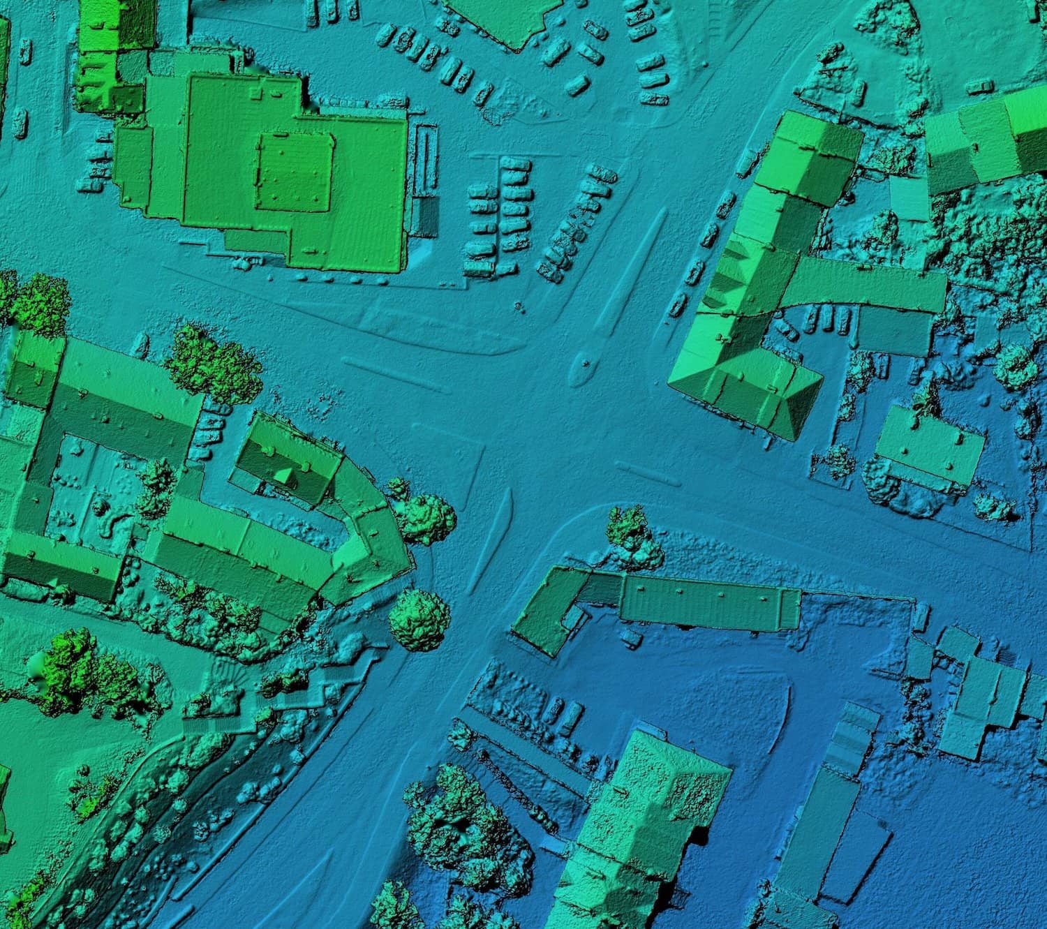
- Urban Planning: Creating detailed 3D models of cities for infrastructure planning.
- Construction: Monitoring progress on construction sites through real-time data collection and analysis.
- Environmental Monitoring: Tracking changes in ecosystems, such as deforestation or coastline erosion.
- Mining: Producing highly accurate 3D models of mine sites for extraction planning and safety monitoring.
The versatility of digital photogrammetry means that it is being adopted in a wide range of industries where rapid and accurate data collection is critical.
These key differences underscore how the evolution from traditional to digital photogrammetry has transformed the field, allowing for faster, more precise, and scalable applications.

Advantages of Photogrammetry in General
Photogrammetry, both traditional and digital, remains a highly valuable technique for collecting spatial data. It offers unique advantages that make it indispensable in a variety of industries, from construction and architecture to environmental science and archaeology. Despite the advancements in technology, the core benefits of photogrammetry—whether done manually or digitally—have remained consistent over time.
Non-Invasive Data Collection
One of the most significant advantages of photogrammetry is that it allows for non-invasive data collection. This means that photogrammetry can capture information about an object or landscape without physically touching or altering it. This is particularly beneficial in sensitive environments, such as:
- Archaeological Sites: Historical artifacts or ruins can be documented in detail without disturbing the site, preserving its integrity.
- Natural Landscapes: In environmental monitoring, photogrammetry can be used to observe and track changes in ecosystems without interfering with the natural habitat.
- Architecture: Buildings and monuments can be surveyed without the need for scaffolding or physical measurements, preserving their structure and aesthetic.
This non-invasive nature makes photogrammetry a preferred method for professionals who need to gather spatial information while maintaining the safety and preservation of the object or environment.
Wide Range of Applications
The versatility of photogrammetry is another key advantage. The technique can be applied to a broad range of industries and use cases, including:
- Mapping and Surveying: Traditionally used for topographical mapping, photogrammetry remains a crucial tool in surveying large areas of land quickly and efficiently. With the use of drones and satellites in digital photogrammetry, mapping has become even more scalable, allowing entire cities or large natural landscapes to be surveyed in detail.
- Architecture and Construction: Photogrammetry can be used to create detailed models of buildings, both during construction and after completion. This is particularly useful in monitoring the progress of a project, as well as in documenting structures for future maintenance or renovation.
- Archaeology and Cultural Heritage: By capturing detailed 3D images of artifacts, ruins, and historical sites, photogrammetry helps preserve cultural heritage. The detailed digital records can be used for restoration, research, and educational purposes.
- Forestry and Agriculture: Photogrammetry has found applications in agriculture for monitoring crop health, planning irrigation, and tracking deforestation. High-resolution images from drones or satellites can be used to analyze plant growth, assess soil conditions, and monitor land use over time.
The adaptability of photogrammetry allows professionals from diverse fields to take advantage of its capabilities, making it a go-to solution for many spatial data needs.
Cost Efficiency
Photogrammetry offers a cost-efficient alternative to traditional surveying and measurement techniques. While other methods, such as laser scanning or ground-based surveying, often require expensive equipment and a significant time investment, photogrammetry provides a more affordable option, particularly in the following ways:
- Lower Equipment Costs: Traditional surveying equipment, such as theodolites or LiDAR systems, can be expensive to purchase and maintain. In contrast, photogrammetry requires only a camera or drone, along with the necessary software, making it accessible to a wider range of users.
- Faster Data Collection: Photogrammetry, especially when using drones or satellites, allows for the rapid collection of spatial data over large areas. This reduces the time and manpower required to complete a project, translating to cost savings.
- Automated Processing: In digital photogrammetry, software handles much of the data analysis, reducing the need for manual labor and specialized expertise. This automation can further lower the costs associated with processing and interpreting the data.
For large-scale projects, such as urban planning or environmental monitoring, the ability to gather and process data quickly and affordably makes photogrammetry an attractive option.
High Level of Detail
Whether using traditional or digital methods, photogrammetry can capture a high level of detail, making it a highly accurate tool for both small and large-scale projects. Some of the factors that contribute to this precision include:
- Multiple Angles: By capturing images from multiple angles, photogrammetry creates a comprehensive view of the object or area being surveyed. This 3D perspective allows for highly detailed models and measurements that reflect the true dimensions and characteristics of the subject.
- High-Resolution Imaging: In digital photogrammetry, the use of high-resolution cameras and sensors ensures that even the smallest details are captured accurately. This is particularly important in fields like architecture and archaeology, where the precise dimensions of objects must be documented.
- Scalability: Photogrammetry is capable of capturing both large landscapes and small objects with the same level of accuracy. For example, it can be used to map entire mountain ranges or to create a 3D model of a small artifact, providing unparalleled flexibility in its applications.
The precision offered by photogrammetry is one of the key reasons it remains a go-to solution for professionals who need detailed spatial data for analysis, modeling, or decision-making.
Photogrammetry offers several significant advantages, including non-invasive data collection, a wide range of applications, cost efficiency, and the ability to capture detailed, accurate spatial data. These benefits make it a vital tool across many industries, and as digital photogrammetry continues to evolve, its use will likely expand further.
