Photogrammetry has been a cornerstone in the fields of mapping, surveying, and 3D modeling for decades. As technology continues to advance, questions arise about whether this time-honored method is still relevant in today’s world, or if it has become obsolete due to the introduction of more sophisticated tools like LiDAR and advanced 3D scanning technologies.

Photogrammetry is a technique that involves capturing photographs and using them to create precise measurements, 3D models, and maps. It works by analyzing multiple images of an object or landscape taken from different angles and distances, allowing specialized software to reconstruct the spatial geometry of the subject.
Historically, photogrammetry was employed for large-scale mapping projects, particularly in topographic surveys and cartography. Over time, the technique evolved with the integration of digital cameras, drones, and advanced computing power. Today, photogrammetry is widely accessible and can be performed using basic cameras, drones, or even smartphones, thanks to advances in software.
Types of Photogrammetry
- Aerial Photogrammetry:
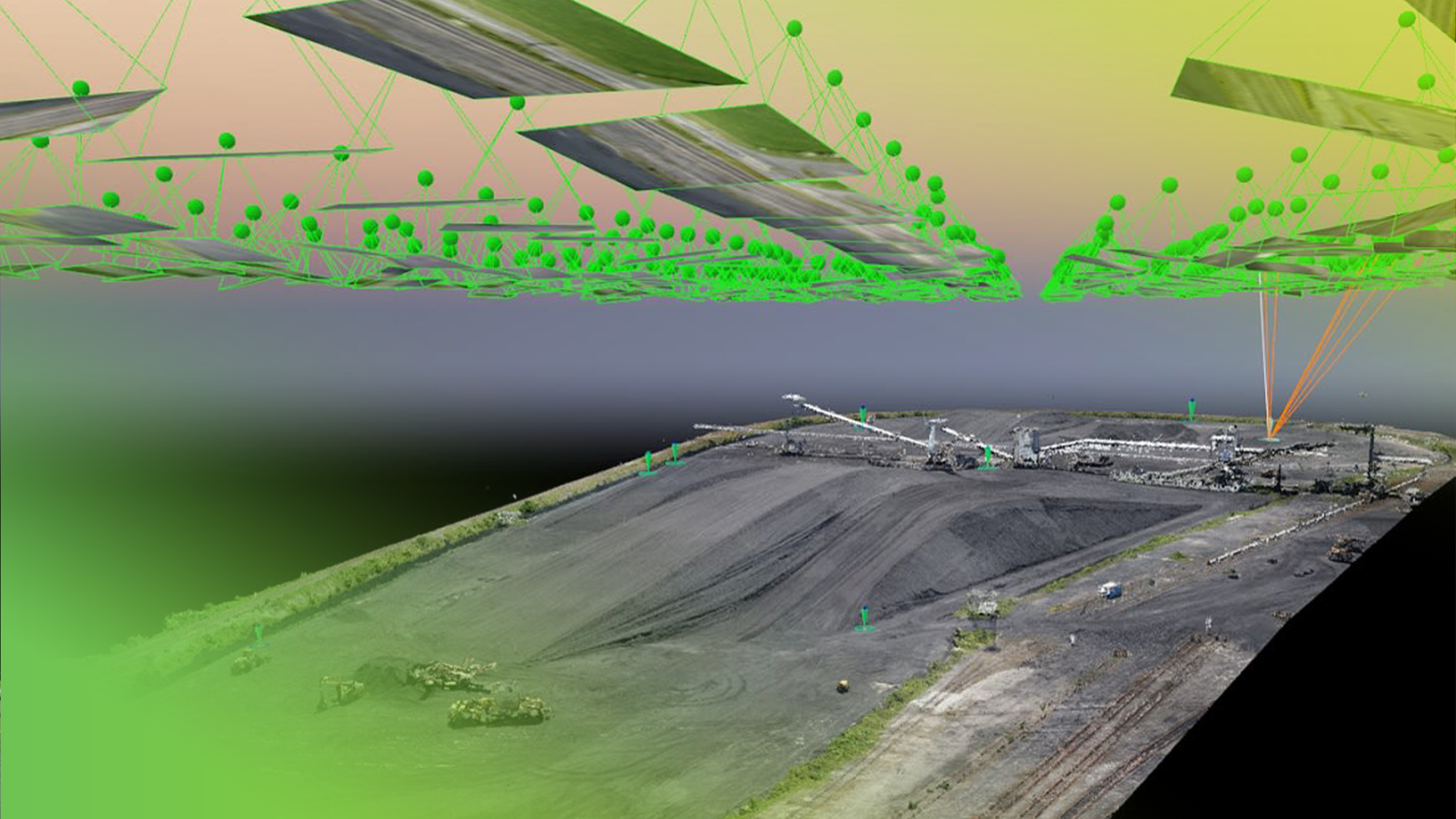
This is the most common form, where images are captured from the air (typically via drones or aircraft) to map large areas. It is frequently used for topographic surveys, construction planning, and environmental monitoring. - Close-range Photogrammetry:
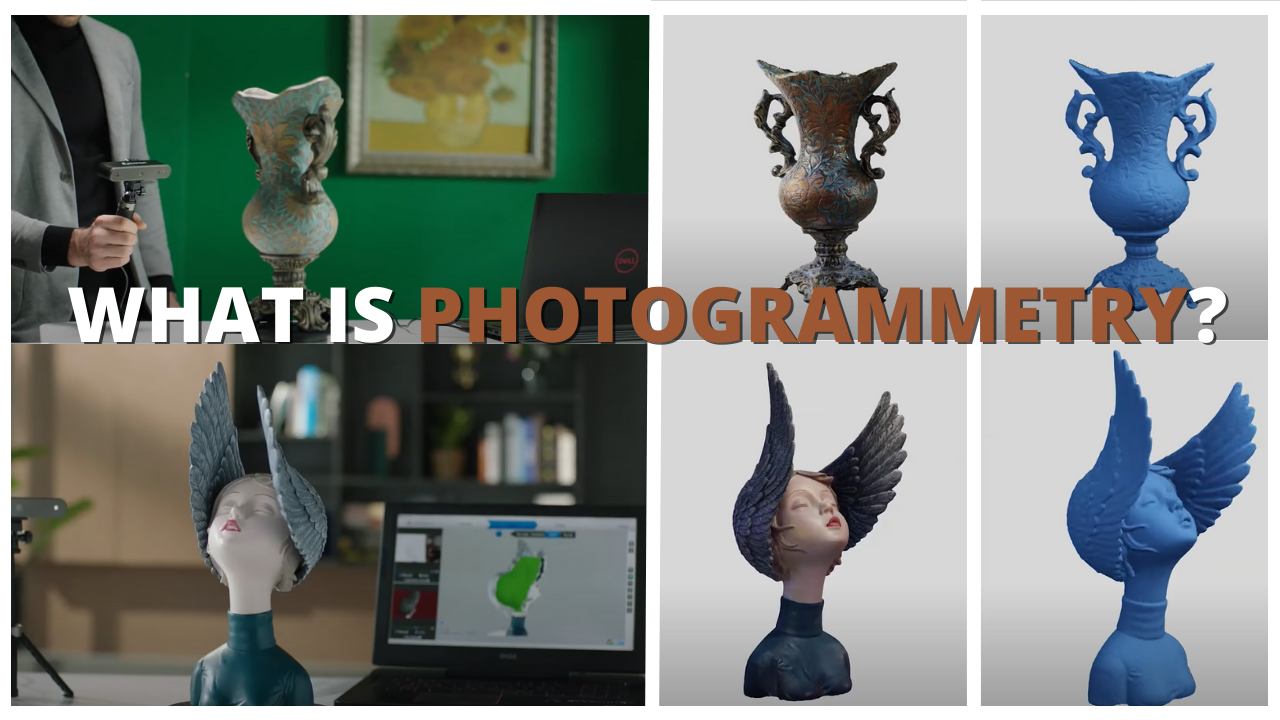
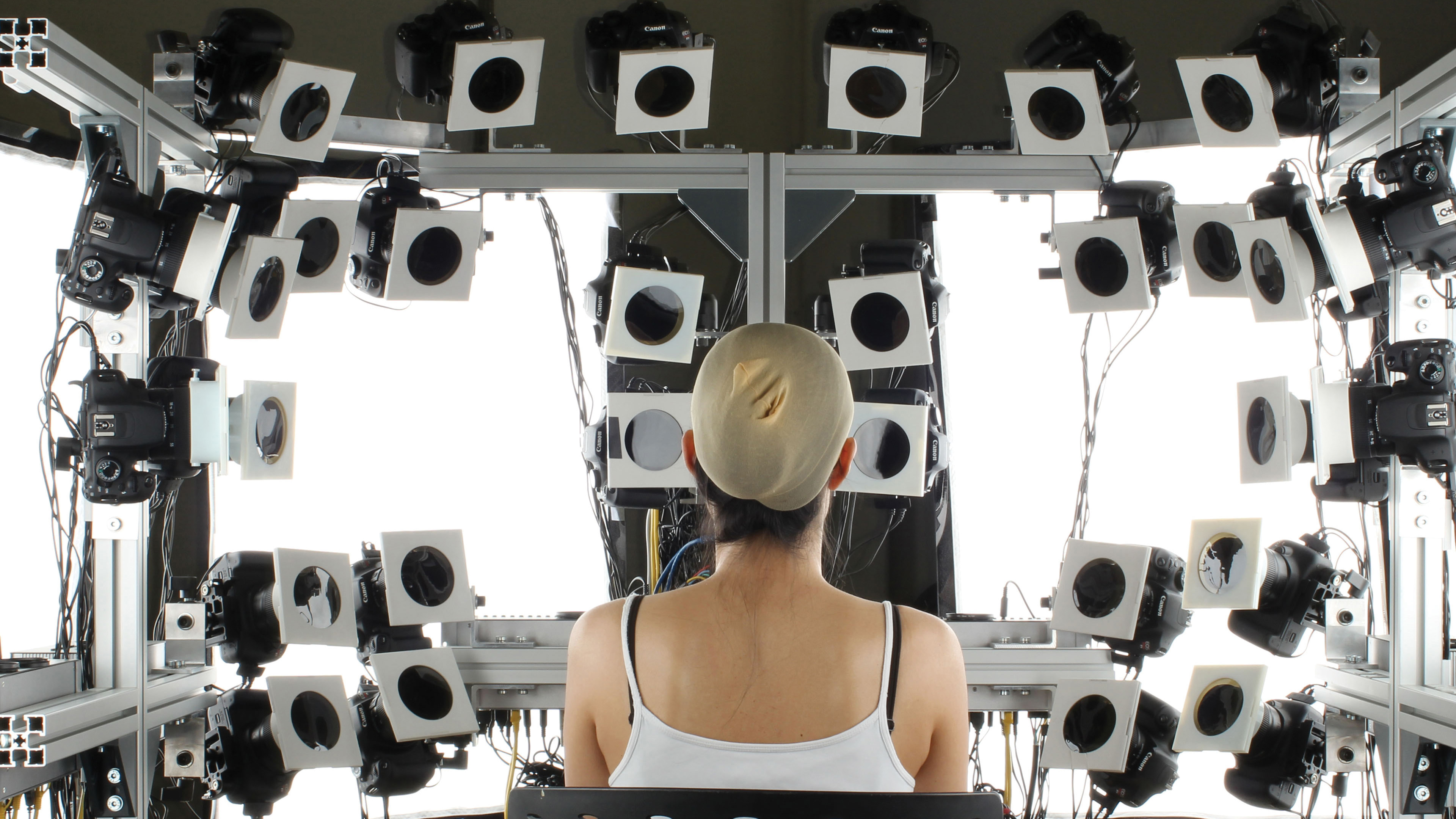
In this type, photographs are taken from a close distance to reconstruct small objects or details, often for heritage preservation, engineering, and media production. - Terrestrial Photogrammetry:
Terrestrial photogrammetry involves capturing images from ground-based cameras, typically used in industries like construction, architecture, and archaeological studies.
Each type of photogrammetry serves different purposes, allowing the technique to be applied across diverse fields, from capturing expansive landscapes to reconstructing detailed 3D models of artifacts.
Key Applications of Photogrammetry
Photogrammetry has played a crucial role across various industries, some of which continue to rely on it heavily even today:
- Architecture:
Architects use photogrammetry to create 3D models of existing structures for renovation or historical preservation. - Archaeology:
Archaeologists use photogrammetry to document and preserve artifacts and excavation sites in high detail, providing a non-invasive way to study delicate historical objects. - Cartography and GIS:
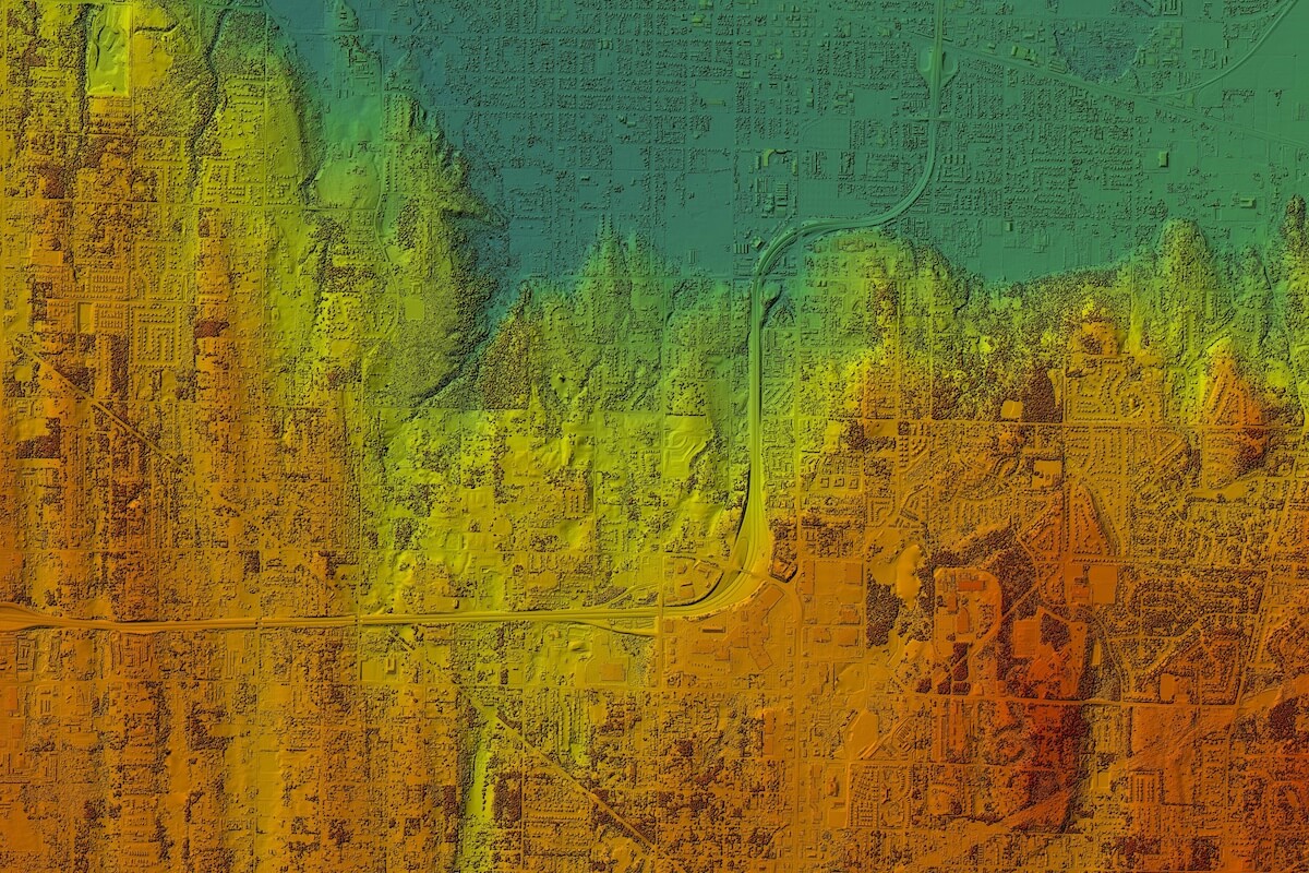
One of the most traditional uses of photogrammetry is in the creation of maps, particularly in Geographic Information Systems (GIS). It allows for precise elevation data, land use surveys, and urban planning. - Engineering and Construction:
In construction, photogrammetry aids in site analysis, progress tracking, and generating detailed 3D models for engineering plans. - Media and Entertainment:
Photogrammetry is increasingly being used in the gaming and film industries to create realistic 3D environments and characters based on real-world objects or locations.

Has Technology Advanced Beyond Photogrammetry?
As technology has rapidly advanced in recent years, the rise of newer, more efficient tools has sparked discussions about whether photogrammetry can keep up or is gradually becoming obsolete.
Modern Technologies Competing with Photogrammetry
Several advanced technologies now rival photogrammetry in different applications, particularly where speed, accuracy, and automation are concerned. These include:
- LiDAR (Light Detection and Ranging):
LiDAR is a remote sensing technology that uses laser pulses to measure distances between the sensor and the surface of an object or terrain. It is widely considered one of the most accurate methods for creating detailed 3D models, particularly for large-scale projects like terrain mapping and urban planning. Unlike photogrammetry, which relies on visible light, LiDAR can penetrate vegetation and even certain atmospheric conditions, offering greater precision. - 3D Scanning Technologies:
A wide range of 3D scanning technologies, including laser scanners and structured light scanning, are now used to capture the geometry of objects and environments. These technologies often outperform photogrammetry in terms of detail and accuracy, especially for close-range projects like industrial inspections, reverse engineering, and medical modeling. - Drones and UAVs (Unmanned Aerial Vehicles):
While drones are also used for photogrammetry, they can be integrated with other technologies like LiDAR and infrared sensors to collect more diverse data. Drones equipped with LiDAR can cover large areas quickly and provide detailed 3D models, bypassing some of the limitations associated with traditional photogrammetry, particularly in areas with complex terrain or poor lighting conditions. - Satellite Imagery and AI:
The integration of satellite imagery and artificial intelligence (AI) in geographic data analysis has also shifted the focus away from photogrammetry. Satellites can now capture high-resolution images of the Earth’s surface, which can be processed and analyzed using AI algorithms to create highly accurate maps and models. This reduces the need for ground-based photogrammetric methods in many large-scale projects.
Comparison Between Photogrammetry and LiDAR
A more direct comparison between photogrammetry and LiDAR shows key differences in their performance across various criteria:
| Criteria | Photogrammetry | LiDAR |
|---|---|---|
| Speed and Efficiency | Slower, especially in post-processing of images | Faster data acquisition, especially for large-scale projects |
| Cost Factors | More affordable, can use consumer-grade equipment | Higher initial costs due to specialized equipment and software |
| Accuracy and Detail | Dependent on image quality, lighting, and angles | Extremely accurate, can penetrate obstacles like vegetation |
| Usability in Different Environments | Struggles with complex terrain and low light | Works well in complex terrains, even in low visibility |
In many cases, LiDAR is preferred over photogrammetry for large-scale surveying, urban planning, and forestry, where its ability to capture highly detailed data in less time is crucial. However, for smaller projects or those where cost is a major concern, photogrammetry still holds its ground.
Does This Mean Photogrammetry is Becoming Obsolete?
Despite the advances in technologies like LiDAR, photogrammetry still retains several advantages:
- Lower Cost: Photogrammetry remains a more cost-effective solution, particularly for smaller-scale projects where the accuracy of LiDAR may not justify the higher expenses.
- Simplicity and Accessibility: With the proliferation of affordable drones, cameras, and user-friendly software, photogrammetry is widely accessible to professionals and hobbyists alike. This accessibility makes it a go-to method in industries like media, construction, and GIS, where precise but affordable solutions are needed.
However, as LiDAR, AI, and 3D scanning technologies continue to improve and become more affordable, photogrammetry may find itself competing in fewer industries. Still, its versatility, accessibility, and cost-effectiveness mean that photogrammetry is far from obsolete in the immediate future.

Advantages of Photogrammetry in Today’s Context
Although technologies like LiDAR and 3D scanning offer advanced capabilities, photogrammetry continues to provide distinct advantages in various industries. These advantages make it clear that while photogrammetry might be challenged by newer tools, it is not necessarily becoming obsolete.
Accessibility and Affordability
One of the most significant advantages of photogrammetry is its low cost and ease of access. Unlike technologies like LiDAR, which require specialized and often expensive equipment, photogrammetry can be performed using widely available consumer-grade tools such as:
- Smartphones with good cameras
- Drones equipped with basic cameras
- DSLR cameras or mirrorless cameras
These devices, combined with relatively affordable software solutions, allow individuals and small businesses to conduct photogrammetric surveys and create 3D models without significant investment. This makes photogrammetry an ideal solution for industries or projects that cannot justify the higher costs associated with LiDAR or other high-end scanning technologies.
Example:
In the construction industry, a small contractor working on residential projects may use drone-based photogrammetry to survey a site and create accurate 3D models. This allows the contractor to provide detailed visualizations to clients without the need for expensive equipment or specialized staff, as would be the case with LiDAR.
Versatility Across Industries
Photogrammetry’s adaptability to various fields makes it incredibly versatile. Its ability to capture both large landscapes and small, intricate details allows it to be applied in many industries, each benefiting from its unique advantages.
- Architecture: Architects continue to use photogrammetry to create models of existing structures, particularly for renovations or historical preservation projects. It allows them to work from accurate representations of old or complex buildings.
- Archaeology: Photogrammetry is particularly useful in documenting fragile artifacts or excavation sites. Its non-invasive nature allows archaeologists to capture detailed 3D models without disturbing the subject.
- GIS and Mapping: Photogrammetry remains a cornerstone in Geographic Information Systems (GIS), especially in areas where high accuracy is required at a lower cost. It is still used extensively for creating elevation models, land-use surveys, and urban planning.
- Media and Entertainment: In film and video game production, photogrammetry is used to create hyper-realistic 3D models of real-world objects and environments. This application is particularly popular because it allows creators to generate digital assets quickly, without the need for manual 3D modeling.
Integration with Other Technologies
Photogrammetry is not just limited to standalone applications; it also integrates well with other modern technologies, enhancing its utility and effectiveness. The hybrid use of photogrammetry and other tools allows industries to benefit from the strengths of both technologies.
For example:
- LiDAR and Photogrammetry Combination: Some projects combine photogrammetry with LiDAR to achieve both high detail and cost efficiency. While LiDAR is used to gather high-precision data in difficult environments, photogrammetry can fill in areas where LiDAR may struggle (e.g., detailed color textures).
- Drone and Photogrammetry Integration: Drones equipped with cameras make aerial photogrammetry faster and more efficient. These drones can capture large amounts of data in a fraction of the time it would take with ground-based methods, making photogrammetry even more useful in industries like agriculture, mining, and environmental monitoring.
Case Study: Heritage Preservation with Photogrammetry
In the field of heritage preservation, photogrammetry is used to digitally archive and reconstruct historical sites. For example, after the Notre-Dame Cathedral fire in Paris, photogrammetry models created before the fire became crucial in planning the reconstruction of the damaged areas. The 3D models provided precise measurements and textures, allowing architects to recreate details lost in the fire accurately.
This case highlights photogrammetry’s ability to contribute to fields that require both accuracy and preservation of visual details, something that can be harder to achieve with technologies like LiDAR, which focus more on geometric accuracy than visual fidelity.
Summary of Advantages
| Advantages | Details |
|---|---|
| Cost-Effective | Can be performed with affordable cameras and software |
| Versatility | Applicable across many industries from architecture to media |
| Ease of Access | Requires minimal equipment investment compared to LiDAR or 3D scanning |
| Integration with Other Technologies | Can complement tools like LiDAR or drones for enhanced results |
| Preservation of Visual Details | Ideal for applications where both geometric accuracy and visual texture are important |
Photogrammetry remains relevant because of its flexibility, cost-efficiency, and adaptability across industries. Whether used alone or combined with modern tools, it continues to offer significant value for professionals looking to create accurate and detailed models.

Limitations of Photogrammetry in Modern Times
While photogrammetry continues to offer advantages in terms of accessibility and affordability, it is not without its limitations. As more advanced technologies such as LiDAR and 3D scanning become available, the weaknesses of photogrammetry become more apparent, especially in certain contexts.
Accuracy Compared to LiDAR and Other Scanning Technologies
One of the most significant limitations of photogrammetry is accuracy, especially when compared to LiDAR or other 3D scanning methods. The accuracy of photogrammetry is highly dependent on several factors:
- Image Quality:
The quality of the images captured for photogrammetry plays a major role in the final output. Poor resolution, lighting issues, or motion blur can significantly degrade the accuracy of the 3D model or map generated. - Lighting and Environmental Conditions:
Unlike LiDAR, which uses laser pulses and can operate in a wide range of conditions, photogrammetry relies on visible light. This makes it sensitive to environmental conditions such as shadows, lighting variations, and weather. For instance, cloudy days, fog, or uneven lighting can distort the accuracy of the model, especially in aerial photogrammetry projects. - Complex Terrain and Vegetation:
Photogrammetry can struggle in environments with dense vegetation or highly complex surfaces. Since the method relies on matching points across different images, objects that obscure the view or create ambiguities (like trees or bushes) can introduce errors. LiDAR, in contrast, can penetrate vegetation and capture the underlying terrain with greater precision.
Time-Consuming Post-Processing
Another key limitation of photogrammetry is the amount of post-processing time required to produce accurate results. While capturing images might be relatively quick, the subsequent steps involve processing those images using specialized software to generate 3D models or maps. This process can be time-intensive, especially for large datasets or highly detailed models.
- Computational Requirements:
Generating a high-quality 3D model from photogrammetric data requires substantial computational power. Large-scale projects with thousands of images can take hours or even days to process, depending on the hardware and software used. In contrast, technologies like LiDAR are often faster in both data acquisition and processing. - Manual Adjustments:
In many cases, manual adjustments are needed to correct errors in the photogrammetry process. For example, if images have inconsistencies due to lighting changes or camera angles, the software may fail to align them properly, requiring human intervention to fix the model. This increases the time and effort needed to produce usable results.
Example:
In the construction industry, using photogrammetry to map a large construction site might involve capturing hundreds of images from a drone. While the image capture could be completed in a few hours, the post-processing could take significantly longer, especially if manual adjustments are needed to correct alignment or accuracy issues.
Scalability Issues
While photogrammetry is suitable for smaller projects or detailed close-range tasks, it can face challenges when scaled up for large projects. The sheer volume of data generated by capturing images of expansive areas can become overwhelming, and the limitations of the technology become more apparent.
- Large-Scale Projects:
For projects involving large terrains or complex urban environments, photogrammetry may not be the most efficient tool. The need for high-resolution images from multiple angles, combined with the extensive post-processing, can make the process less scalable compared to alternatives like LiDAR. In contrast, LiDAR can cover vast areas more efficiently and with greater accuracy. - Storage and Management of Data:
The data generated from high-resolution photogrammetry can be immense, requiring significant storage and computational resources to manage. For example, a photogrammetry project covering several square kilometers could produce terabytes of image data that need to be stored, processed, and analyzed, which may not be practical for all organizations.
Case Study: Urban Planning and Photogrammetry Limitations
In urban planning, photogrammetry is often used to map cities and model buildings for infrastructure projects. However, as cities grow and become more complex, photogrammetry faces challenges in accurately capturing the intricate details of urban environments. Tall buildings, narrow streets, and dense areas with overlapping structures make it difficult for photogrammetry to create accurate models without significant manual intervention.
In contrast, LiDAR systems mounted on drones or aircraft can capture urban environments with greater precision, even penetrating through obstacles like trees or urban vegetation. This makes LiDAR a preferred choice for large-scale urban planning projects, where scalability and accuracy are crucial.
Summary of Limitations
| Limitation | Details |
|---|---|
| Accuracy | Dependent on image quality, lighting, and terrain |
| Environmental Sensitivity | Affected by weather, shadows, and vegetation |
| Post-Processing Time | Requires significant computational power and time for large datasets |
| Scalability | Challenges in managing large-scale projects with complex environments |
| Data Storage | Large amounts of data require substantial storage and management resources |
These limitations highlight the areas where photogrammetry falls short in comparison to more advanced technologies like LiDAR. However, understanding these challenges allows industries to make informed decisions about when photogrammetry is appropriate and when other technologies might be a better fit.